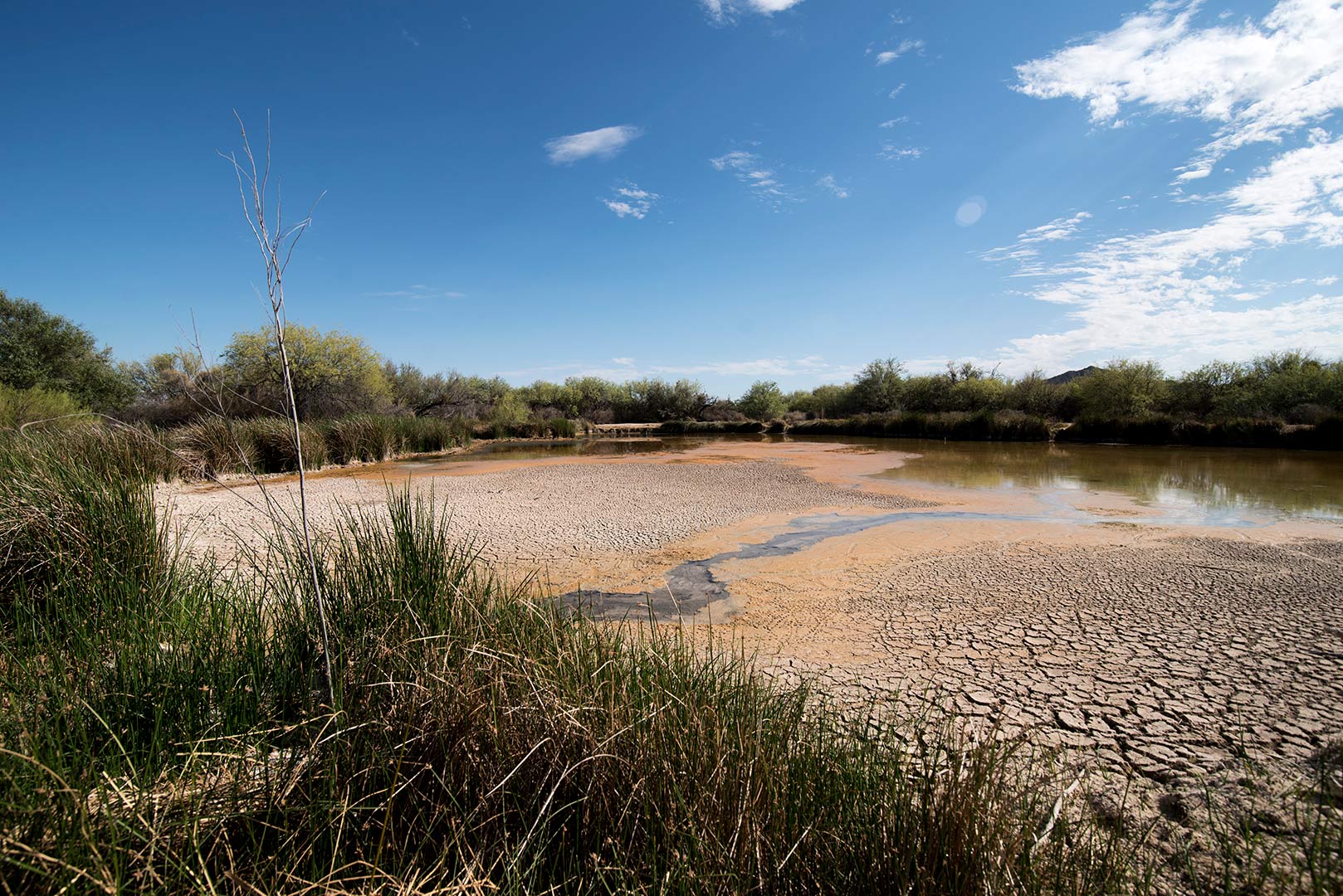
 Quitobaquito is the last natural habitat in the U.S. for endangered species like the Sonoyta mud turtle and pupfish. But leaks in the man-made pond's base have dropped water level low enough to reveal cracked mud flats on July 18, 2020. The park's natural and cultural resource manager Rijk Morawe says animals could be relocated from the pond if it gets too low.
Wedged between a sprawl of Saguaros and a busy highway in Mexico, Quitobaquito is a tiny oasis.
Wildlife and Indigenous communities have long relied on this rare spring system for freshwater in the middle of the Sonoran Desert.
The spring flows into a pond just a few paces from the U.S.-Mexico border at Organ Pipe Cactus National Monument. Hia C-ed O'odham and the Tohono O'odham tribal members lived and passed through here long before the park or the border existed.
But the site is in peril. Many worry ongoing construction on the Trump administration's border wall could be to blame.
Quitobaquito the only natural habitat in the country for endangered species like the Sonoyta pupfish and mud turtle. But University of Arizona professor and ecologist Michael Bogan says he's awed by the sheer abundance of life there.
"You’re at this place, the spring, in the middle of one of the driest parts in the Sonoran Desert and yet it is jam packed with aquatic life," he said.
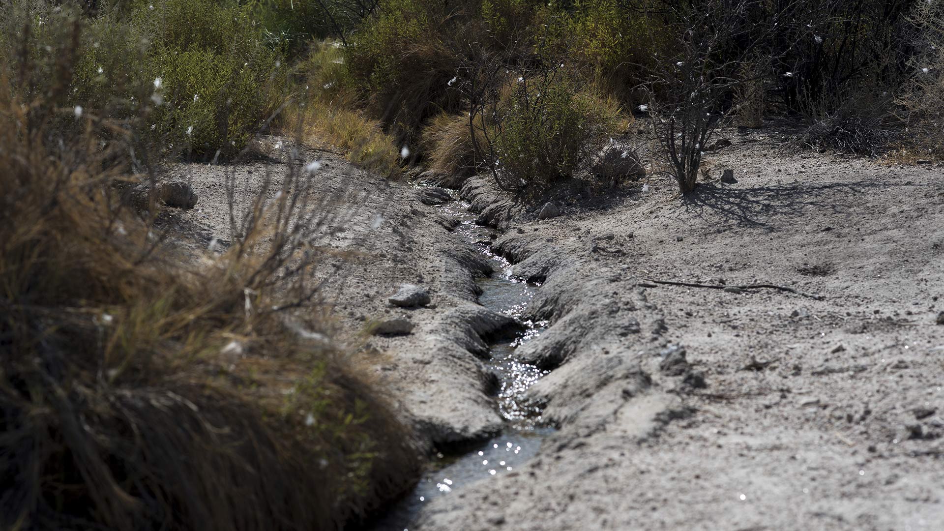 VIEW LARGER A channel of Quitobaquito Springs can be seen in a thicket of vegetation above the pond on July 18, 2020.
 But this summer the pond has sunk so low that cracked mud flats appear in several places where water used to be. Bogan said the spring used to flow at around 30 gallons per minute but has been in decline for years. Yearly flow now averages around 10-15 gallons per minute.
Earlier this month, USGS data showed a flow of five and a half gallons per minute. Bogan says that's the lowest it’s been in over a decade.
"I know that when there were some leaks previously, the water level got that low, but I think it’s really the combination of the shocking aesthetic of the low water in the pond but also the declining spring flow," he said.
But the rest of the landscape is also changing. Contractors hired by the Department of Homeland Security are building a 30-foot tall border wall across almost 30 miles of the park. That involves digging trenches, widening roads and pumping groundwater to mix cement.
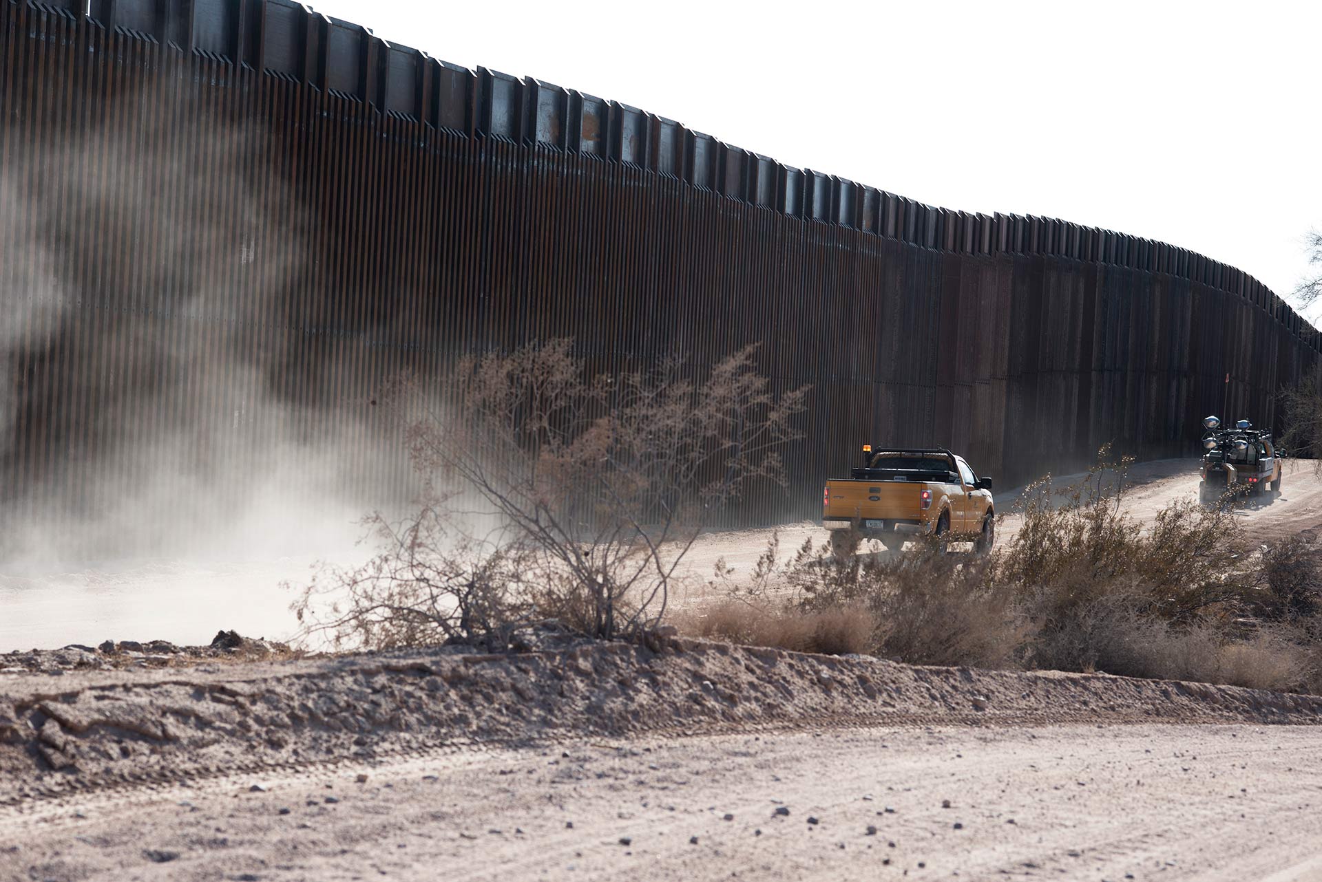 VIEW LARGER A Kiewit Corporation truck drives along an access road along the border wall east of Quitobaquito Springs at Organ Pipe Cactus National Monument on July 18, 2020.
 Bogan says what’s happening now at the spring and its pond have been years in the making, but recent construction activity could be making things worse.
"What we have here is basically a worst case scenario where we have declining spring flow, declining water coming into the pond and a structural problem with the pond itself. And then the construction traffic, heavy duty trucks and trenching," he said. "On top of that, we're in the hottest month of the year."
Organ Pipe Cactus National Monument Resource Manager Rijk Morawe said the pond has been leaking intermittently since 2006 and got worse in January. He said years of drought and agricultural drilling in neighboring Sonora have depleted the aquifer that feeds the spring. This is the first year the spring’s levels are being continuously monitored. Morawe said the numbers are concerning, but he’s skeptical of some of the data so far.
"We’re not really confident in the data we’re getting from the transfuser," he said.
Morawe said the park has carried out a few of its own spring measurements this month that show a faster flow. USGS stands by their collection methods and says they monitor the device frequently. They say some extreme dips and spikes could be attributed to algae getting caught in the system or a mud turtle passing through.
Last fall, Customs and Border Protection said it would need 84,000 gallons of water per day but agreed not to drill within five miles of Quitobaquito. Morawe said the park has requested up-to-date extraction figures, but the government hasn’t given them.
"We don’t have any idea how much they’re pulling out the ground," he said. "We don’t have any way of confirming whether it’s 84,000 gallons or less or more."
But Morawe doesn’t believe wall construction is playing a role in Quitobaquito’s decline. Hydrologist and UA Hydrology and Atmospheric Sciences Department HeadThomas Meixner said that’s probably true, at least for now.
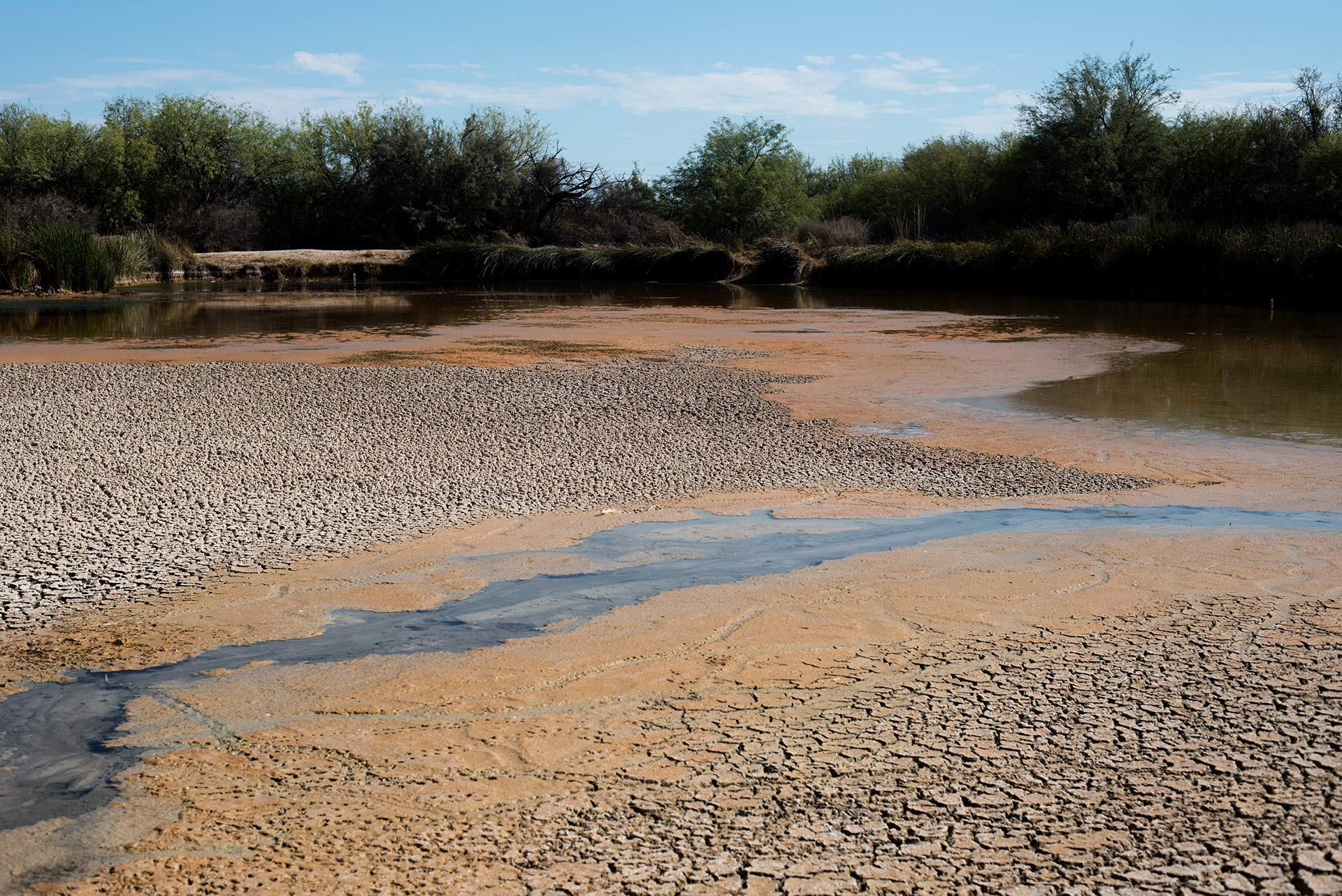 VIEW LARGER Cracked mud flats appear on the surface of Quitobaquito pond on July 18, 2020.
 "What’s the specific impact of the border wall construction? Right today, it’s hard to attribute how much of it. In the long run, we know it’s going to have an effect," he said.
Meixner said that’s because the effects of groundwater extraction don’t show up that quickly. Still, he said any additional drilling from the aquifer should be avoided because the water level will be impacted eventually.
Morawe said a well for the border wall is located seven miles west of Quitobaquito on the Cabeza Prieta National Wildlife Refuge. Another one sits within Organ Pipe's boundary, about eight miles east of the spring. Meixner said the impact from those distances wouldn't have appeared in the last few months, but will show up eventually.
"Once the spring dries out, it might take a very long time for the spring to come back," he said. You could do things today, and you might not see the effect of it for 20, 30, 50 years, 100 years."
Meixner said scientists are still studying Quitobaquito, the Rio Sonoyta across the border and the deep aquifer that feeds them both.
Customs and Border Protection declined to answer questions about water usage and well location, but said in an email that the agency is monitoring spring levels and consulting with US Fish and Wildlife to minimize damage.
By submitting your comments, you hereby give AZPM the right to post your comments and potentially use them in any other form of media operated by this institution.