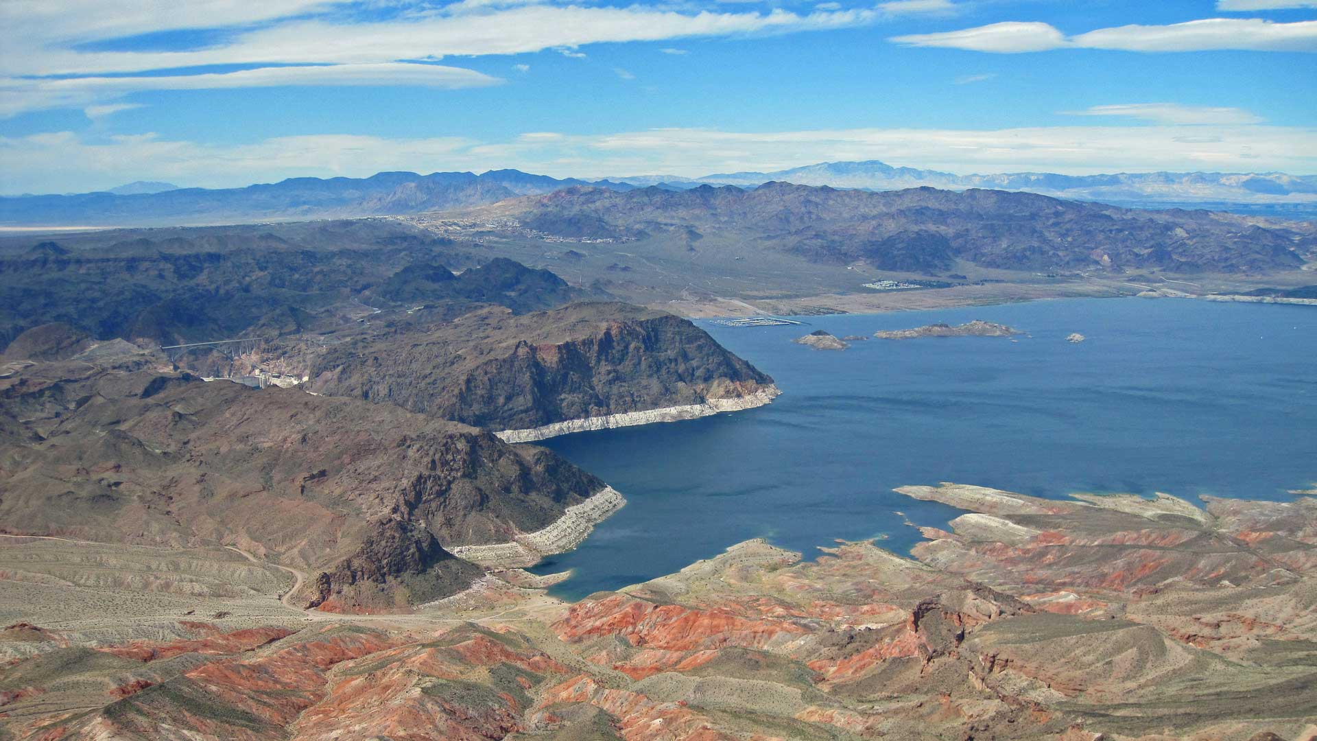
 Looking out on Boulder Basin, Lake Mead.
FLAGSTAFF — Snow swamped mountains across the U.S. West last winter, leaving enough to thrill skiers into the summer, swelling rivers and streams when it melted, and largely making wildfire restrictions unnecessary. But the wet weather can be misleading.
Climate change means the region is still getting drier and hotter.
"It only demonstrates the wide swings we have to manage going forward," James Eklund, former director of the Upper Colorado River Commission, an interstate agency that ensures river water is doled out properly, said earlier this year. "You can put an ice cube — even an excellent ice cube — in a cup of hot coffee, but eventually it's going to disappear."
For the seven states relying on the Colorado River, which carries melted snow from the Rocky Mountains to the Gulf of California, that means a future with increasingly less water for farms and cities.
Climate scientists say it's hard to predict how much less. The river supplies 40 million people in Arizona, California, Colorado, Nevada, New Mexico, Utah and Wyoming as well as a $5 billion-a-year agricultural industry.
The U.S. Bureau of Reclamation on Thursday will release its projections for next year's supply from Lake Mead, a key reservoir that feeds Colorado River water to Nevada, Arizona, California and Mexico.
After a wet winter, the agency is not expected to require any states to take cuts to their share of water.
But that doesn't mean conditions are improving long term. Arizona, Nevada and Mexico could give up some water voluntarily in 2020 under a drought contingency plan approved by the seven states earlier this year.
Here is a look at the Colorado River amid climate change:
Colorado River flow
Much of the water in the Colorado River and its tributaries originates as snow.
As temperatures rise and demand grows, the water supply declines. Even if more snow and rain fell, it wouldn't necessarily all end up in the river. Plants will suck up more water, and it will evaporate quicker.
Brad Udall, a water and climate research scientist at Colorado State University, said the river's flow could decrease even further to 20% by 2050 and 35% by 2100.
"On any given day, it's hotter, we have more days for a growing season to occur, we have a thirstier atmosphere," he said. "When you put all those things together, you lose flow in the river."
Climate change
Climate change doesn't mean the American West will be hot and dry all the time. Extreme swings in weather are expected as part of a changing climate — something Udall has called "weather whiplash."
The Southwest got a reprieve this year with average and above-average snowfall following a year that sent many states into extreme drought. Nearly empty reservoirs quickly rose, including Lake Mead and Lake Powell — the largest manmade reservoirs in the country that hold Colorado River water.
The lakes still are far below capacity, steadily declining since 2000 with a bigger spike after winter 2011.
A wet year interrupting years of dryness isn't uncommon.
"We're very thankful for this gain in wet hydrology and storage in the reservoirs that happened this year, but we know we can lose it just as fast," said Carly Jerla with the U.S. Bureau of Reclamation.
Drought
Many states declared an end to short-term drought this year, based on the U.S. Drought Monitor, which looks at land conditions.
The map is produced by the National Drought Migration Center, the U.S. Department of Agriculture and the National Oceanic and Atmospheric Administration.
But not all agencies use the same indicators for drought.
The U.S. Bureau of Reclamation uses Lake Mead on the Nevada-Arizona border and Lake Powell on the Arizona-Utah border. The reservoirs were nearly full in 1999 before the agency declared a drought the following year that hasn't let up. As of Monday, Lake Powell was 57% full and Lake Mead was 39% full.
Jerla says the bureau won't say the drought is over until those reservoirs fill completely, which won't happen without consecutive years of wet weather.
Protecting the river
The seven states that rely on the Colorado River signed a plan earlier this year to protect the waterway from climate change and keep Lake Mead and Lake Powell fuller.
The drought contingency plan is meant to keep the reservoirs from dropping so low that they cannot deliver water or produce hydropower amid prolonged drought and climate change.
Nevada, California and Arizona voluntarily would give up water when Lake Mead reaches certain levels, as would Mexico, which also gets a portion of water from the river. The deal expires in 2026, and the states will begin negotiating new guidelines next year.

By submitting your comments, you hereby give AZPM the right to post your comments and potentially use them in any other form of media operated by this institution.